This is Dog Island February 23, 2011.
The guys left at 7:20 to start the crossing.
The view off the fly bridge at the start of the trip.
The view off the fly bridge later that same day.
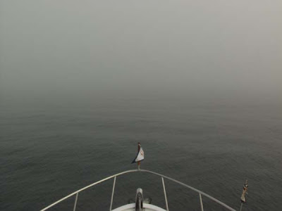
At 4:00 pm the fog rolled in and lasted until 2:00 am the next morning. Motoring through the fog was scary for everyone on board.
Captain George stands by while Captain Mike watches over things from the captain’s chair. After the fog moved in it got cool.
Looking out on the foggy gulf.
The guys saw dolphins during the entire trip. They were surprised to see them at night. The dolphin could be seen at night playing in the bow wave of the boat, under the navigation lights.
Captain Shay takes his turn at the helm.
Looking at the first marker into Boca Grande. This was the first marker after 257 miles.
Below is a map showing the route they took across the Gulf.
This shows the Boca Grande Inlet and Burnt Store Marina.
Condos at the entrance into Charlotte Harbor.
They tied up at the Burnt Store Marina at 3:30 pm February 24, 2011. The trip took 35 hours. Shay said it would have been a perfect crossing if it hadn’t been for the fog. The trip from East Bay to the entrance to Boca Grande Inlet was 257 miles, taking them as far as 67 miles off shore at one point.
George and Mike left to start their trip back to Niceville to pick up our car and start back to Mount Airy. They were tired but wanted to travel some before it got too late. We enjoyed having them on the boat and appreciated their help doing the crossing and getting our car back home. They are great friends.
We had dinner at the marina with Dave and Brenda, a Canadian couple on the boat “The Old Grouch”.


No comments:
Post a Comment